
I’m vacationing in the State of Washington this week, and I had a fantastic day yesterday– I went to Neah Bay, something I’ve wanted to do for a long time.
Tonight, I’m in the land of vampires–
![250px-Mr_Edward_Cullen[1]](http://melissastacy.com/wp-content/uploads/2014/07/250px-Mr_Edward_Cullen1.jpg)
Forks, Washington.
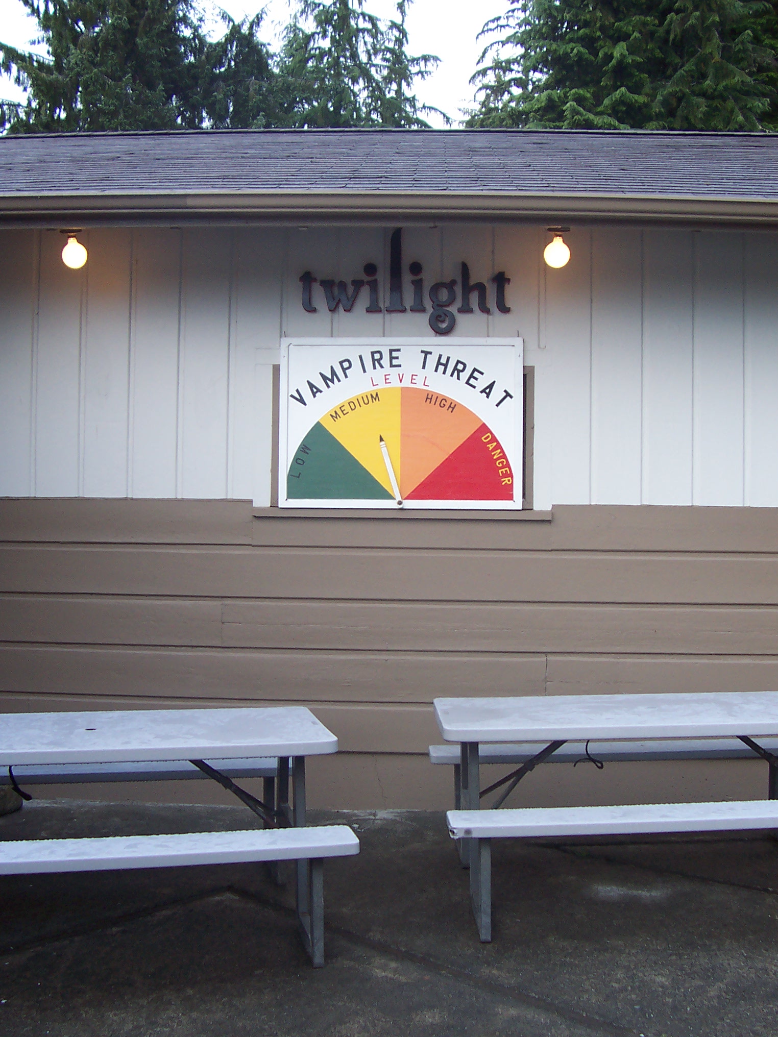
The setting of Twilight. And Twilight is a big deal here. A very big deal.
Luckily, I picked a good day to visit the small town of Forks– according to this gas station sign, the Vampire Threat Level right now is only Medium.
But more on the vampires in a minute. I want to talk about Neah Bay first.
The old fishing town of Neah Bay is the center of the Makah Indian Reservation, located 75 miles west of Port Angeles. Neah Bay isn’t much of a town– a lot of rundown homes and trailers, battered automobiles and yards full of rusty, broken things. I asked Greg to drive around town a bit, and we bottomed-out the Prius in a hole in the road by the school.
Greg was pissed about that. He didn’t understand why I wanted to tour Neah Bay at all, and bottoming-out the car made him lose it. “Why are we doing this?? Are you trying to wreck the car??” So I said, okay, fine, let’s just go to the cultural center.
On the way, Greg stopped at this shop to buy some smoked king salmon–

which used a smoker made of two 55-gallon drums welded together, and burned alder wood for the smoke. That’s a bath tub propped up near the door, and there were about six small dogs and puppies running around. They were really cute!
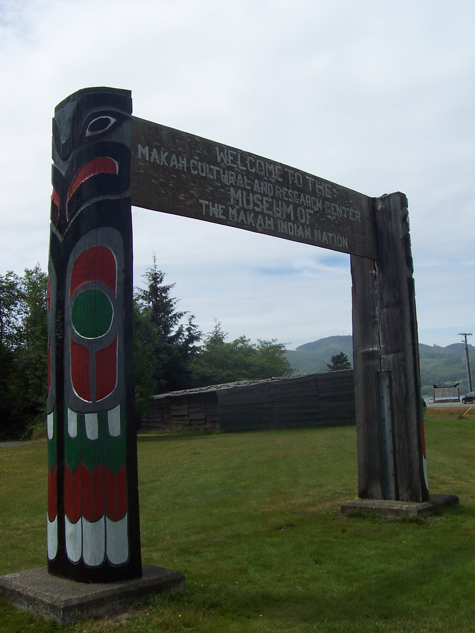
After that, we drove to the Makah Museum, also known as the Makah Cultural & Research Center. This is the welcome sign by the road.
Five hundred years ago, a mudslide buried the Makah village of Ozette (a coastal village not far from Neah Bay), and the Ozette site was unearthed by archaeologists in the 1970s. They discovered an amazing wealth of objects preserved in the mud– including a dog hair blanket!!! (Fabric!! Survived in the mud for 500 years!! Amazing, right??)
The permanent gallery of the Makah Museum exhibits a selection of the objects uncovered from Ozette, as well as a number of other artifacts from later centuries that illustrate Makah life before European sailors, loggers, and settlers started infiltrating the area– first by boat, and then by land.
Unfortunately, I couldn’t take any pictures inside the museum. There was even a ban on sketching the objects displayed. (!!) So I have nothing to show for my two hours of meticulously reading every single display–
But I can tell you that the Makah are an amazing people, and their fishing and whale-hunting techniques were incredibly sophisticated. I was awed by the beautiful fish hooks they used, each one designed with a particular shape and material (bone, wood, or stone) for each type of species they hunted. The Makah also fished with nets, something white people (a.k.a. the United States government) denied for a long time, insisting that nets had been “brought” to the Makah by white traders. The Ozette site proved that the Makah had been fishing with nets long before European sailors arrived.
The Makah lived in a type of communal home called a longhouse, which had a high, sloped roof where they would hang fish to smoke. A longhouse is what modern Americans would call an “open concept” design– built without interior walls. Each Makah family that lived in a longhouse had their own hearth and living space, and the museum has a perfect replica of a longhouse for guests to walk through.
The Makah also bred a species of dog for wool-making purposes– they would weave the dog hair on a loom and make blankets and other materials with the fabric. (The loom on display– unearthed from the mudslide– was amazing!)
The Makah diet was mostly all seafood, mixed with a celery-like vegetable that grew wild by the coast, small berries (salal berries, they might have been called), and a root vegetable known as an “Ozette potato” which supposedly has more flavor than a white potato. (I know the potato comes from South America, but I don’t think the Ozette potato was brought to this region by trade, but is an indigenous plant– of course, I could always be wrong! The placard I read didn’t specify.)
There was a whale-hunting canoe on display, a beautiful collection of wooden boxes and reed baskets made of all different materials, toys, combs, a bow and quiver for otter hunting (which the Makah hunted for their pelts, as well as various seals and sea lions– though they would try to sneak up on the sea lions and club them, rather than hunt them with arrows)– there were also cooking supplies, plates and bowls– it was such a great collection of artifacts!
One last detail I want to share, that really stands out in my mind–
There is a species of shark that hunts a particular fish, a large fish (and I’m sorry, I can’t remember the name– long pike or something– I wasn’t carrying a notebook because of the ban on sketching, or I would have written it down)–
Anyway, the shark will devour the body of the fish, but won’t eat the head.
So the head will float around in the ocean, and eventually, it will wash up on shore months later.
The Makah would then eat the head.
The head of this fish was “safe from rot in the brine” of the saltwater, which is why the Makah could eat the months-old meat after it washed up on shore.
I loved this museum!!
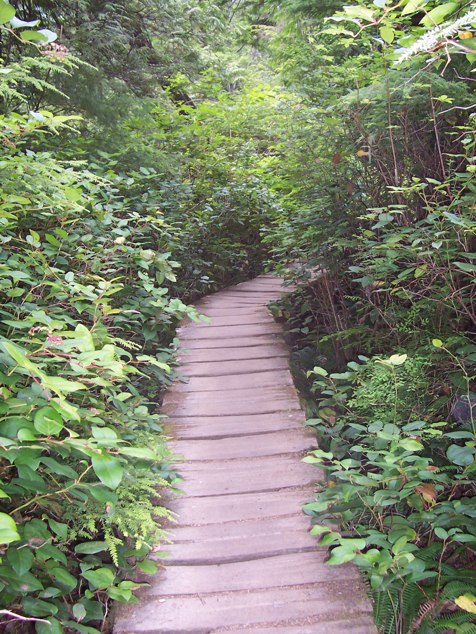
After Greg and I left Neah Bay, we drove west a few miles, to the most northwesterly point of the contiguous United States, which is called Cape Flattery. We followed a 3/4-mile trail through the woods to reach the tip of Cape Flattery, a trail which was mostly covered by a small boardwalk–
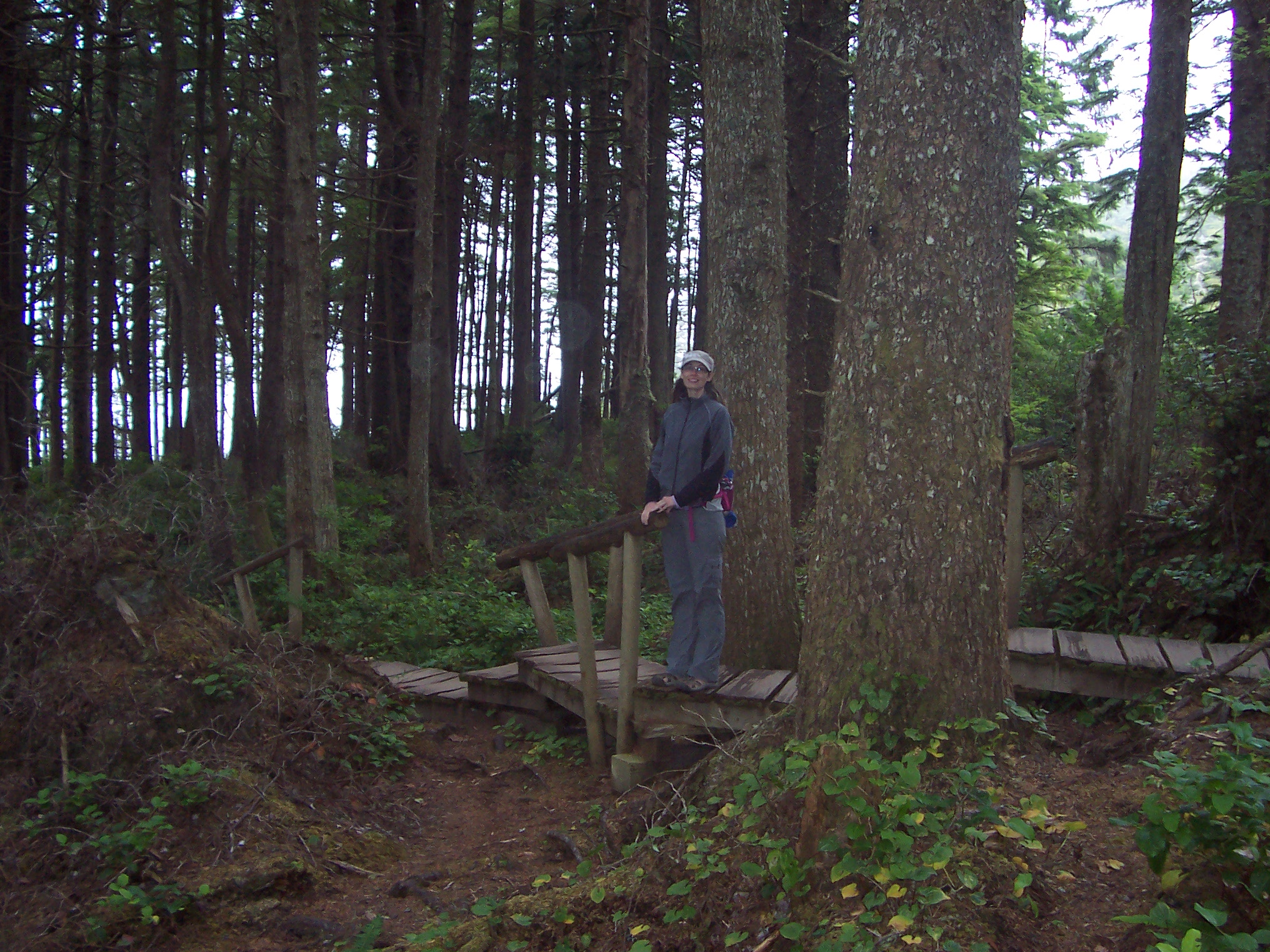
Greg took this picture of me in a section with steps. You can see the ocean in the distance.
At the end of the trail was a wooden viewing platform. Here is the view to the left of the viewpoint–
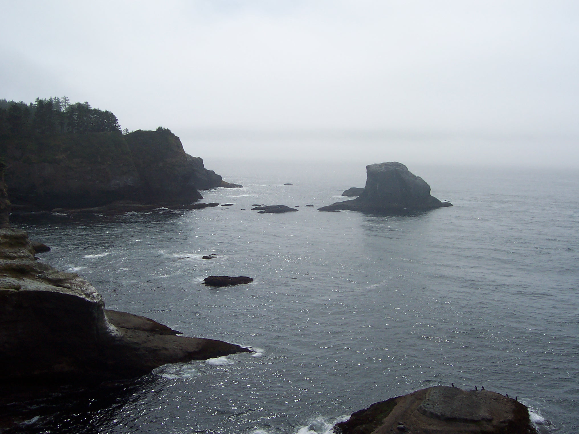
Straight ahead, staring out into the Strait of Juan de Fuca, sits Tatoosh Island–
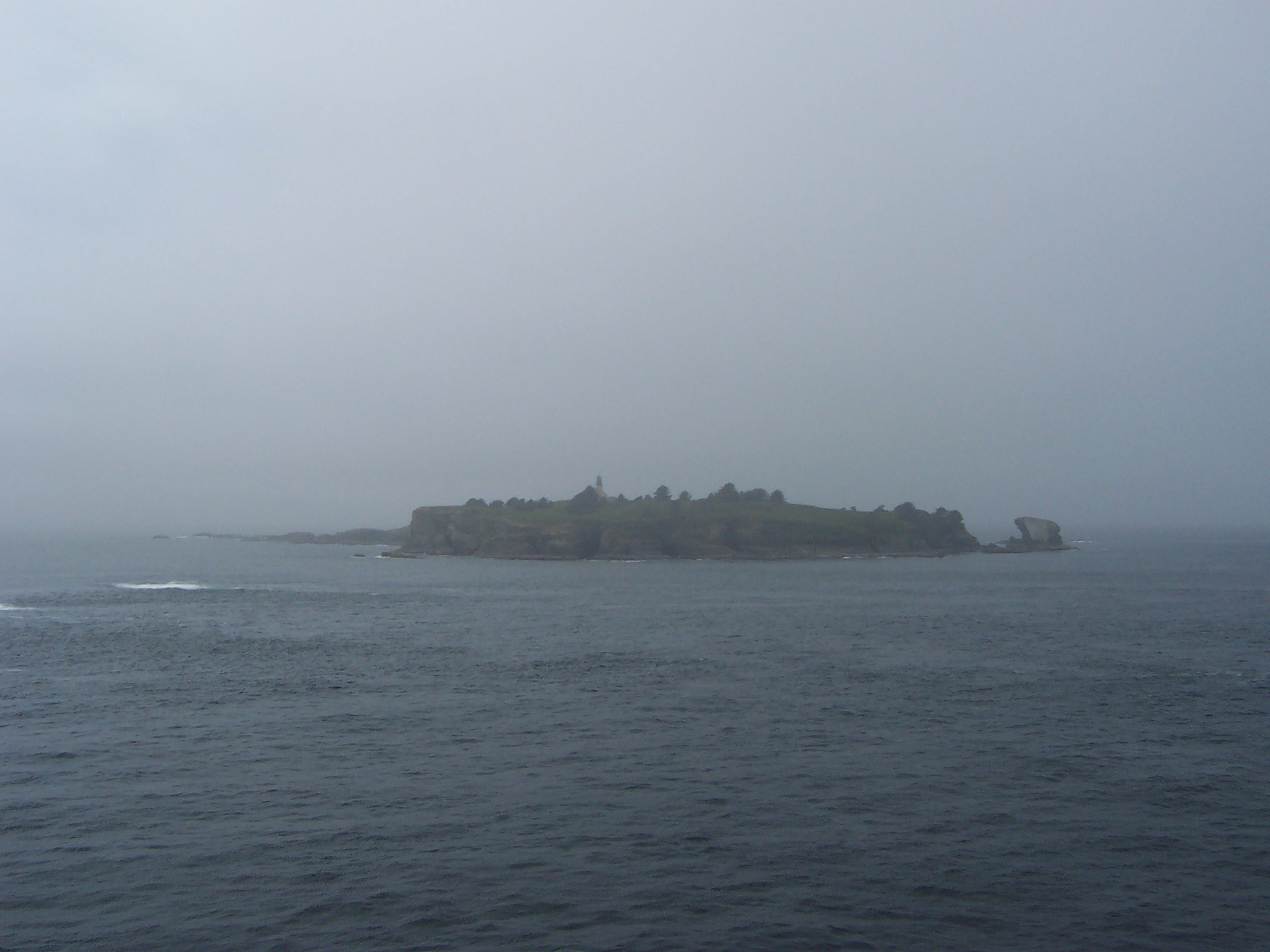
which has a lighthouse and Coast Guard station (sorry you can’t really see them in my picture)– Greg says they built the lighthouse there after a Chinese ship collided with a Japanese ship and both sank. Beyond Tatoosh Island is Canada, of course, which was much easier to see than my misty photo would lead you to believe.
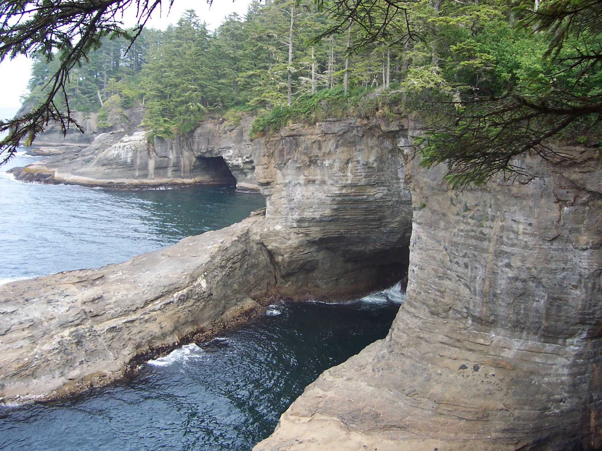
Here is the view to the right of the overlook point:
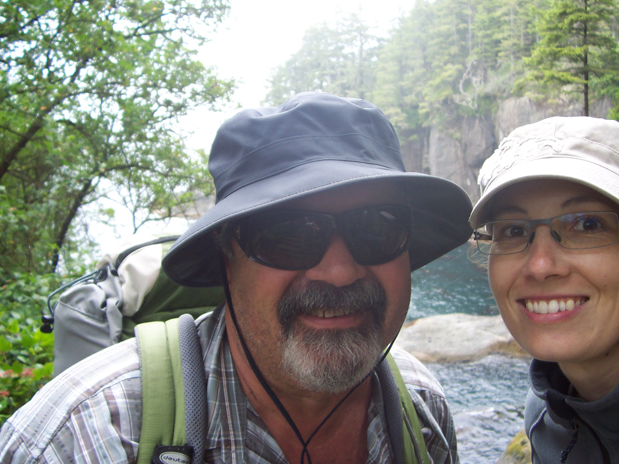
And here is a selfie I took on our walk back to the car:
The ocean water near shore was this beautiful dark teal that was so, so pretty. Blue and green are such heavenly colors; mix them together and you get orgasmic shades of awesome, which was how the sea looked on Friday.
After our trip to Cape Flattery, we drove back to Port Angeles, and I stopped at two grocery stores for directions to Oceanview Cemetery (it wasn’t the easiest place to drive to). But I was determined to get there, because I wanted to visit Raymond Carver’s grave. When we finally found the cemetery, Greg gazed over that long sweep of headstones and said, “How are you going to find this guy’s grave?” because there was no one there to ask. But I was like, “Don’t worry. I’ll find it.”
And I did. I cut across the cemetery, heading due west, made a sharp right turn, and walked straight to it.

A lot of animals use the electromagnetic field of the earth as a navigation tool. I often use something similar to that– though I don’t know what anyone would call it. I think all humans have it. The automatic knowing. The intuitive pull. The instinctive awareness that our bodies can take us to the exact place we need to be, if we just follow our feet.
That’s how I found Raymond’s grave, approximately 120 seconds after arriving at a large cemetery I’d never been to before.
I started reading aloud this inscription–
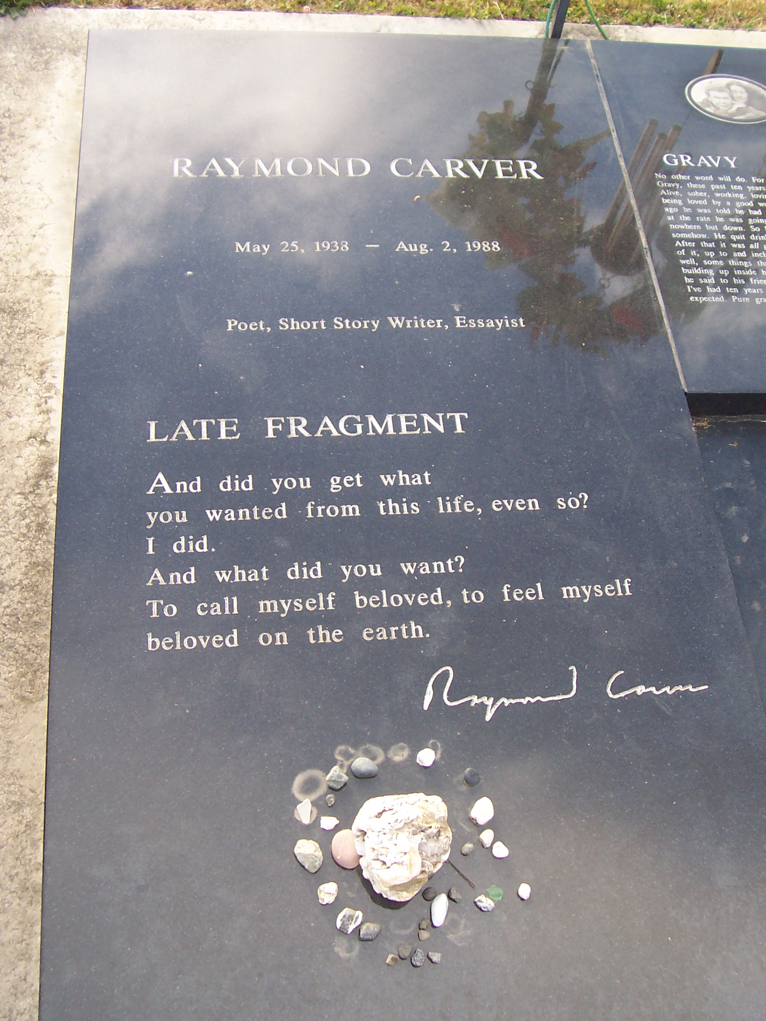
And had to stop, overwhelmed, and wipe away tears before I could finish.
And did you get what
you wanted from this life, even so?
I did.
And what did you want?
To call myself beloved, to feel myself
beloved on the earth.
I wasn’t crying because I was sad Raymond Carver was dead, or because death makes me sad, or because I myself am sad to die. I have felt all of those sadnesses before, most especially while studying the Holocaust and other genocides around the world, and I know my sudden weeping wasn’t motivated by sadness.
My tears were just the fact that this is all I want from my life, too– to call myself beloved, to feel myself beloved on the earth.
And it was this knowledge– that I have achieved my desire, and can happily die at any moment, knowing that I have lived my life to the best of my abilities– that was what caught me up with tears. A strange happiness. Like a relief. A deep knowing. The same thing that took me right to this grave to begin with.
The center section held another message from Raymond–
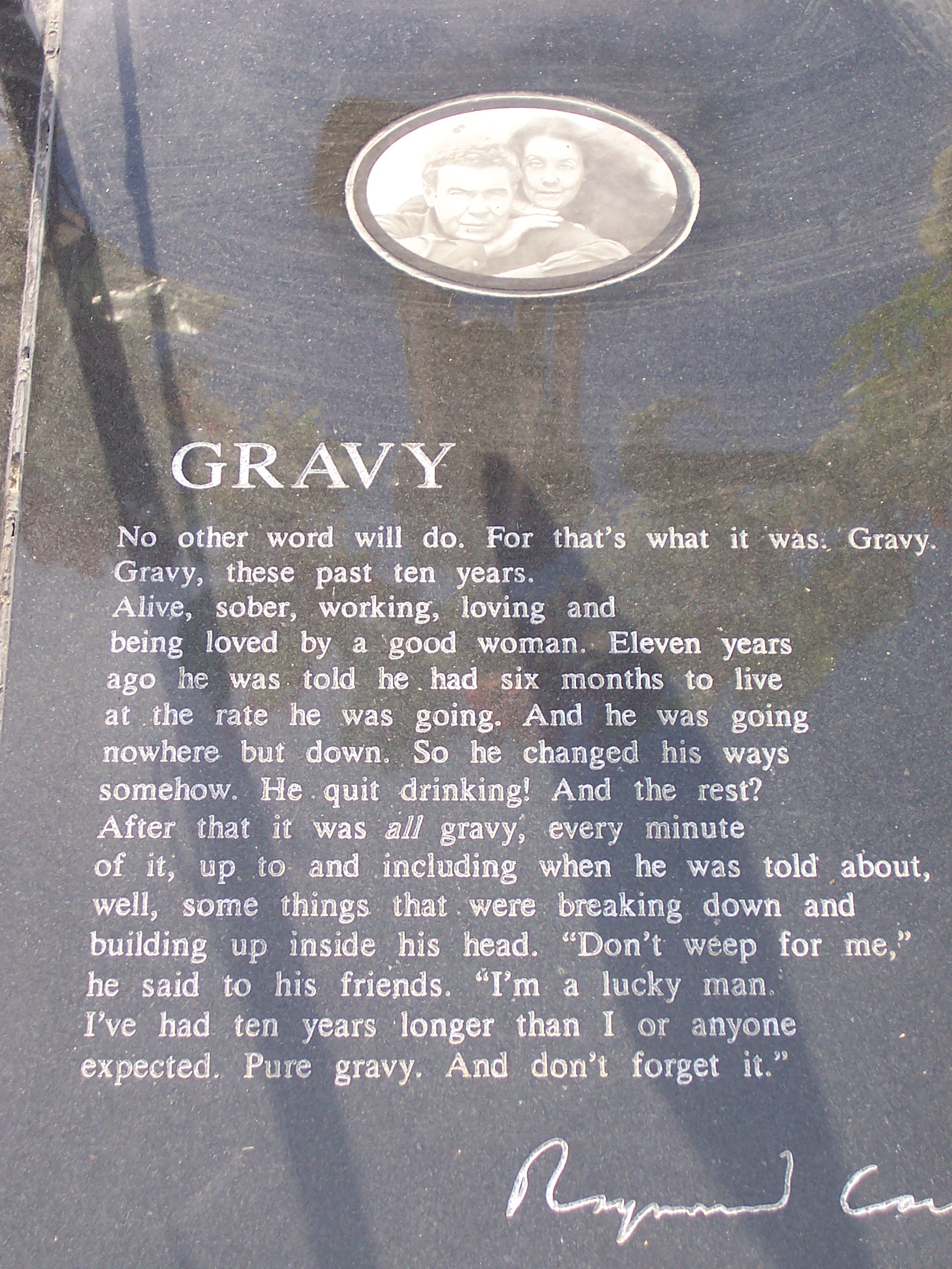
which has a picture of Raymond with his wife, who is still alive, and will be buried beside him one day.
Greg took a seat on the bench–

and it really is lovely, the view from this beautiful cemetery.
We stayed the night in Port Angeles, and on Saturday morning, we drove into Olympic National Park.
Here is the view from Hurricane Ridge:
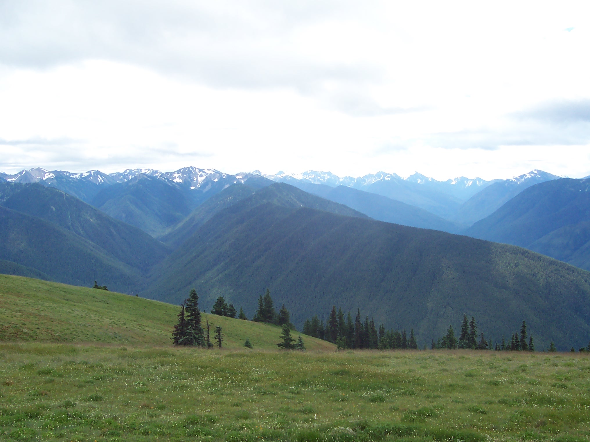
which looks astoundingly similar to home. The San Juan Mountains of Colorado.
Here is a picture of the visitor center at Hurricane Ridge:

There’s a café and gift shop in that building, as well as a large indoor picnic area. The temperature outside hovered around mid- to low-fifties and low-sixties, and it was really windy. Keep in mind that we’re only a few miles from sea level here. It’s a stunning display of geography. One that also happens to look like I’m in Silverton, Colorado.
Greg and I didn’t hike here. We drove out of the park, and reentered on another road to see the Elwha River.
There are no roads that cross Olympic National Park– only short entrance roads scattered around the perimeter. The interior of this park is penetrated only by foot, ski, or snowshoe– so you can only see the tiniest, tiniest fraction of this park by vehicle.
The Elwha River was dammed in 1913, and a second dam was built in 1927. Because this river once had one of the most productive salmon runs in the Pacific Northwest, the Elwha River Ecosystem and Fisheries Restoration Act was passed by Congress in 1992. By 2011, tear-down of the dams began. This is one of the largest dam removal projects in history. The Elwha Dam (1913) has been completely dismantled, but the removal of the Glines Canyon Dam (1927) is still underway. So Greg and I could only travel the Elwha River road partway before we had to turn back.
We went to the Sol Duc River road next. This road leads to a hot springs lodge, which is a bunch of cabins built near three (very tiny) hot springs pools that are actually really ugly bright blue pools with no shade. The pools were extremely crowded (sardines in a hot springs) and gave me a people overload after three minutes of being out of the car. I went back to the Prius and just told Greg, “Uh, no.”
We fled.
We did a .5-mile Ancient Groves forest walk instead. Here is Greg beside one of the giant Douglas firs–
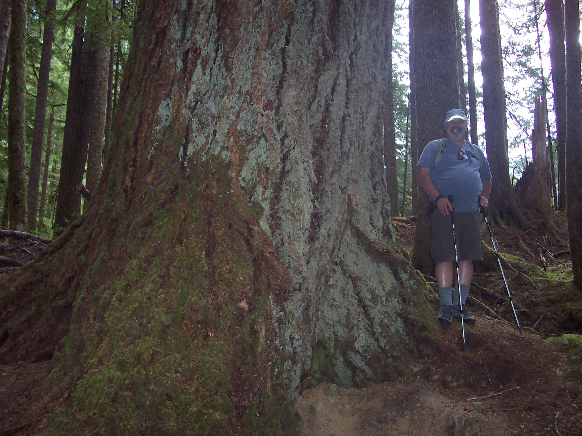
We had a little picnic of cheese, wine and crackers, and then drove an hour or so to VAMPIRE COUNTRY.
Except I didn’t know it was Vampire Country. I thought we were just driving to Forks, an old logging town.
But according to the Spring/Summer 2014 edition of the North Olympic Peninsula Guide, “Die-hard Twilight fans, eager to see the location of author Stephenie Meyer’s best-selling books, travel to the North Olympic Peninsula to retrace the footprints of their favorite characters. Although none of the movies was filmed in the small town of Forks, people from all over the world have come to the West End, making stops everywhere from Forks High School, where Bella and Edward met, out to La Push, where Bella visits her werewolf friend, Jacob. You’ll spot the famous ‘The City of Forks Welcomes You’ sign as you enter, where many fans have had their pictures taken.”
I had Greg pose by the (famous?) sign as we drove into town–
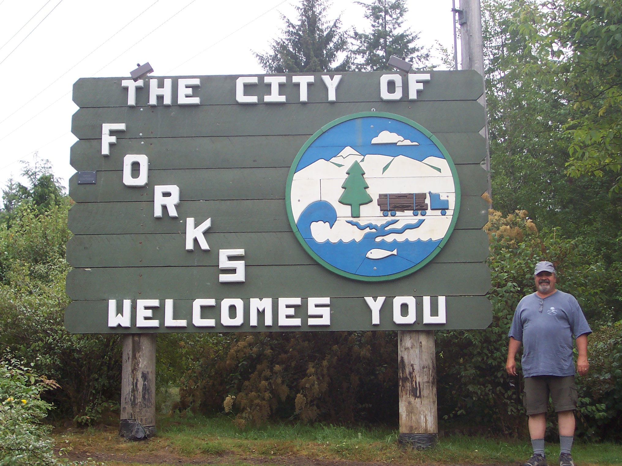
I didn’t watch the movies (or did I? I think I saw the first one? Because I remember the scene with vampire baseball)– at any rate, I have no recollection of seeing this sign– but here is my wonderful husband being my stand-in Twi-hard fan like the trooper he is.
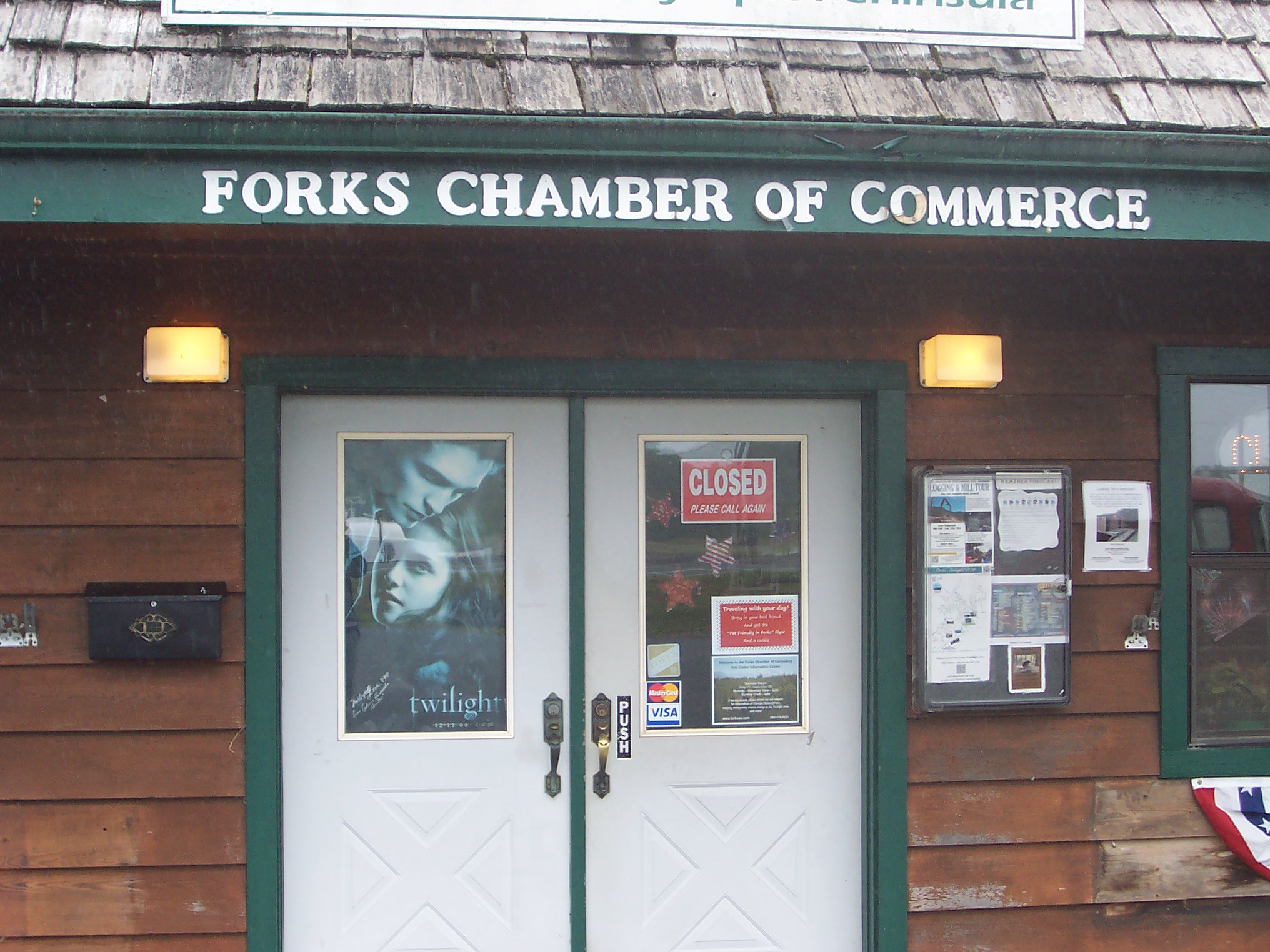
And here is a Twilight poster on the door to the Forks Chamber of Commerce–
And right next to the entrance is a pair of pickups, though it is this orange one–

That has this piece of paper on the dash–
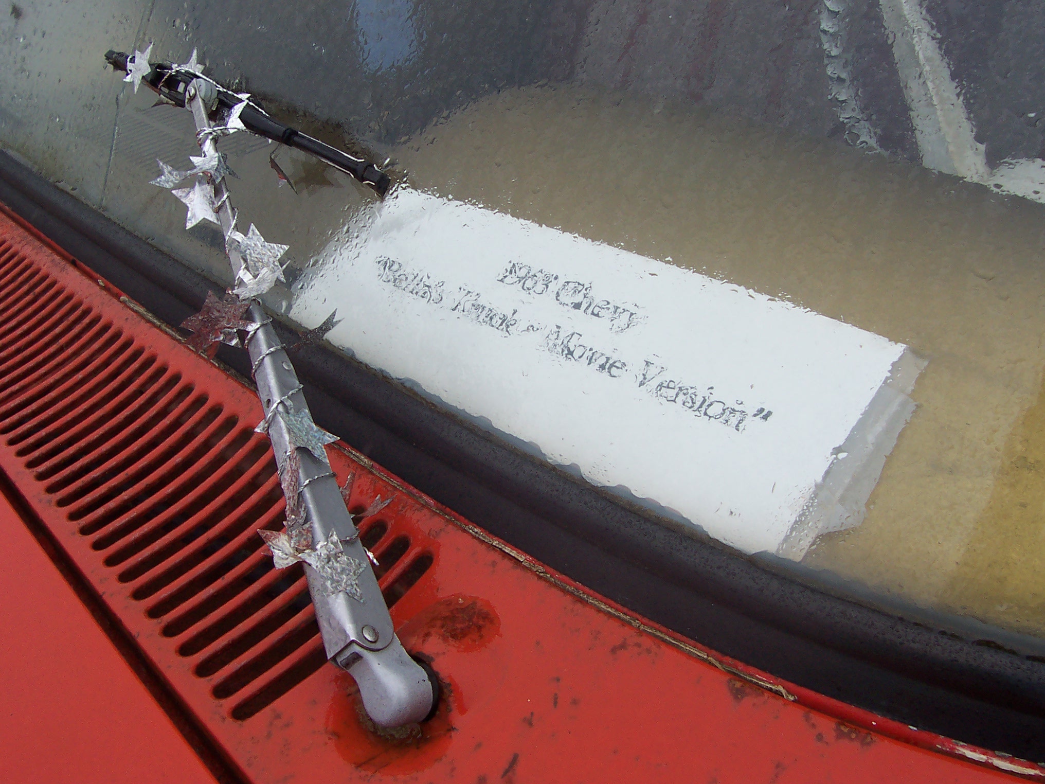
1963 Chevy– “Bella’s Truck– Movie Version”
There are little shimmery star-cords strung all over this vehicle. The license plate of the red truck beside this Chevy reads BELLA.
Most of the places in town have the word “Twilight” or “Vampire” or “Breaking Dawn” in their shop names or window displays– Bella Swan is everywhere here.
Here is another amazing factoid from the North Olympic Peninsula Guide:
“Although Meyer didn’t have specific Forks homes picked out when she described them in her books– she didn’t visit Forks until after the first book was completed– the Forks Chamber of Commerce has dubbed a couple of homes as those of Bella and Edward.”
Fans then go to these homes and pose in pictures in front of them.
(!!!)
About 15 miles west of Forks is the tiny town of La Push, on the Quileute Indian Reservation.
This was one of the places I was planning to visit, and thank goodness I was prepared to see Twilight stuff, or this sign on the way to La Push might have thrown me–
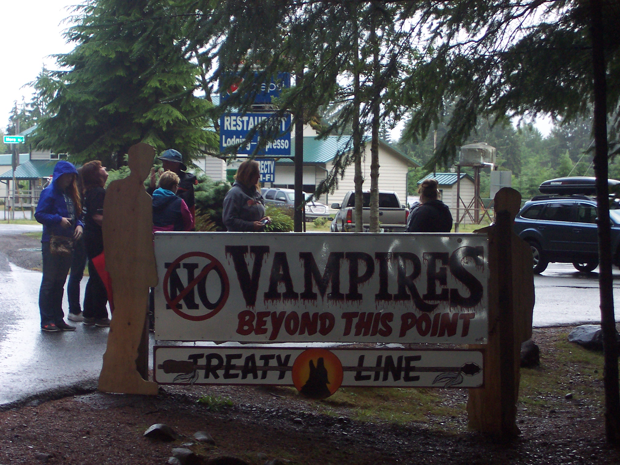
No Vampires Beyond This Point
The young women on the other side of the sign are admiring the “Welcome Twilight Fans” printed on the reverse– which they posed around in a picture right after I took this photo.
Those women were part of a tour group. Here is the back of their bus–
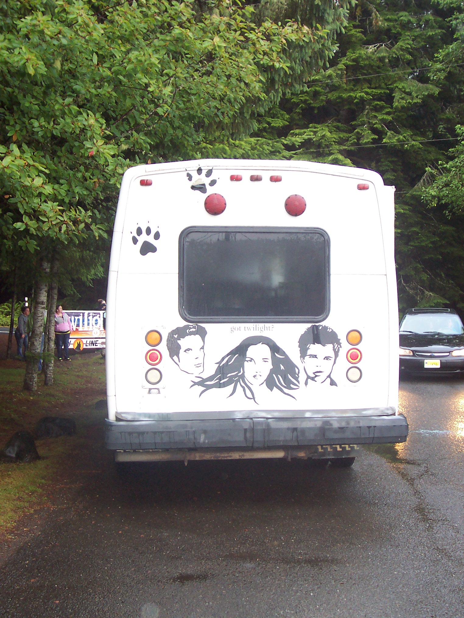
That’s Edward, Bella, and Jacob, in case you can’t tell.
Here is the side of the bus–

I’m including this picture in case anyone wants to call the number listed for tour details. The front of the bus said Team Forks above the windshield.
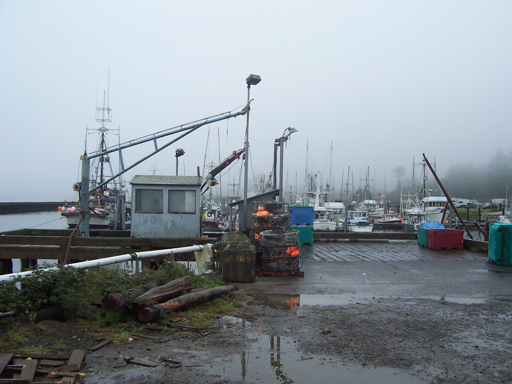
Twilight fan busses aside, La Push is a really small, really cool town. There’s a busy harbor–
And all kinds of giant, cool rock formations in the sea–
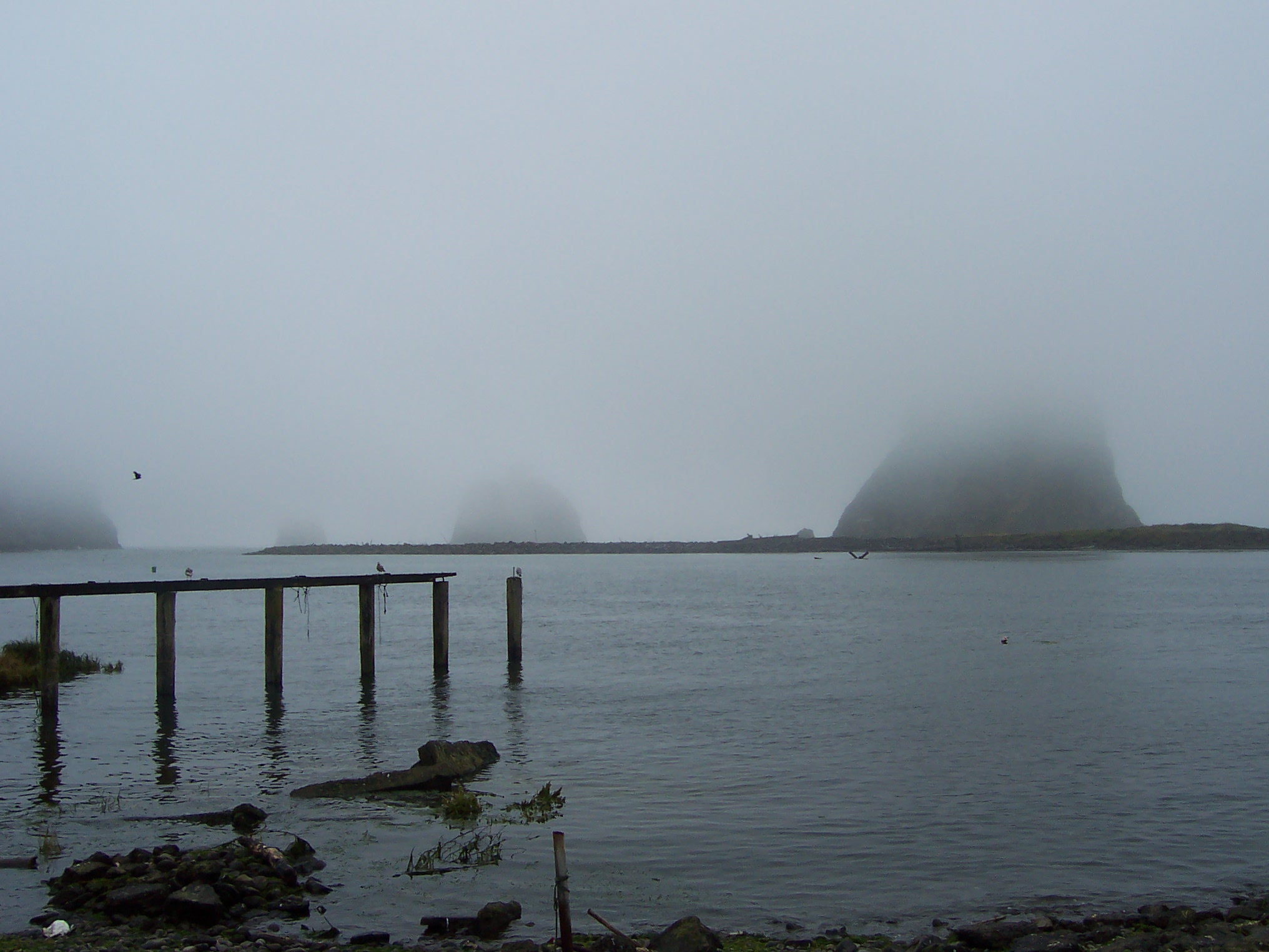
This was a place with powerful, vibrant energy. The kind of place where I would stay for a summer just to soak up that energy while I write.
Greg and I had dinner at a restaurant on the water, and I asked the hostess (a junior in high school here) what she thought of the Twilight fans flocking to the reservation. She said it was good that they brought in money, but annoying that there was now a “Bella cabin” overlooking the beach, and all of the other Twilight details.
I asked her if Jacob was named in the book as a Quileute Indian, and she said, “I don’t know, I didn’t read the books. Or watch all of the movies.”
She then told me that, because Jacob was from La Push in the books, the Quileute Tribal Council was allowed to send a representative and one student from town to Hollywood for each of the movie premieres. She was selected as the student to attend the second film. “What did you think of it?” I asked. She shrugged. Gave me one of those teenager looks. “It was okay.” With a tone of voice that meant, honestly, it pretty much sucked, let’s change the subject.
The big weekend celebration of Quileute Days was taking place while we were in town–
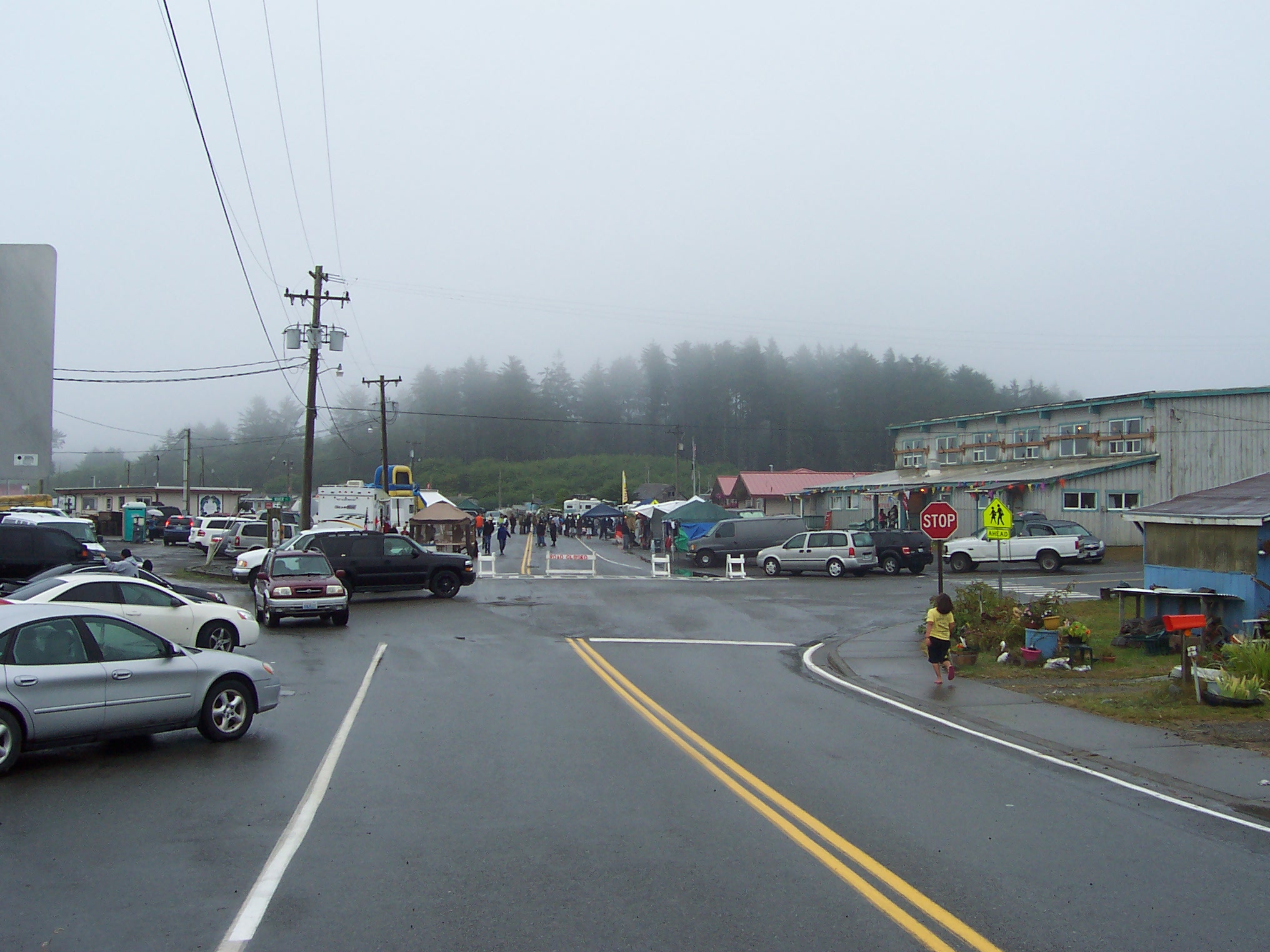
you can see the large community center on the right, in which people were drumming and dancing inside, and there were ten or so little carnival-type tents set up on that street, selling food and toys. Greg and I bought some homemade ice cream at one.

Here’s the Quileute Tribal School bus. The school is located very close to the ocean (you can see more of those rock formations over the bus).
Back in Forks, we found a room for the night at the Town Motel, which features a kitchen–
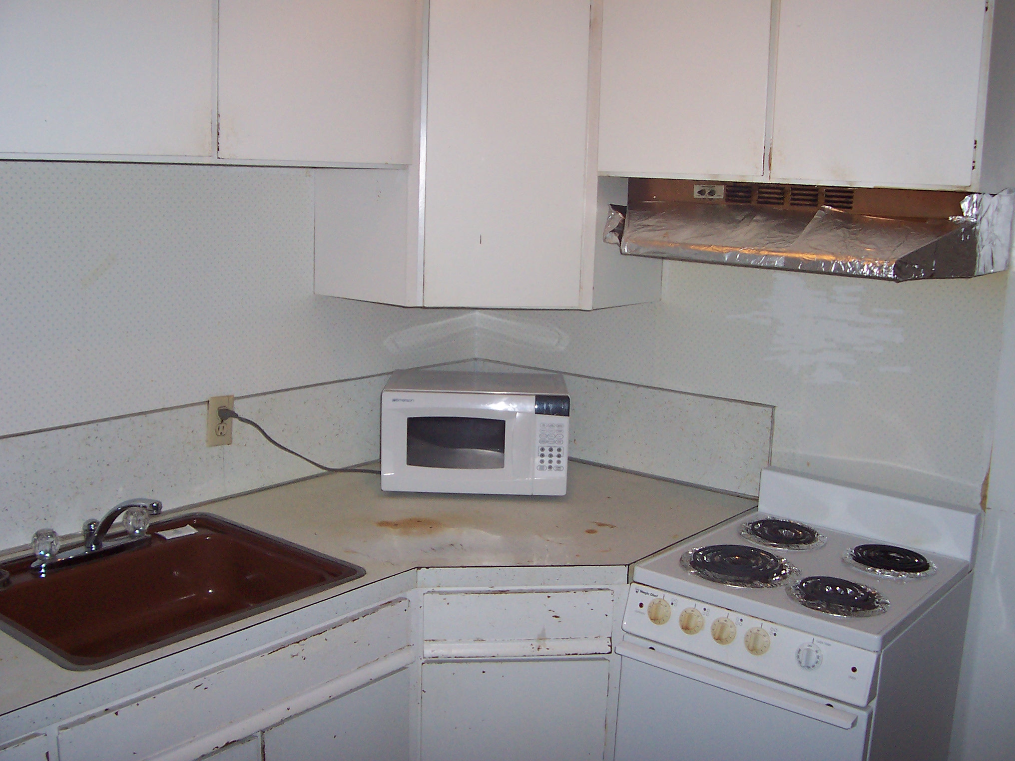
the foil and the stains all over the counter being quite lovely.
Also, the bathroom–
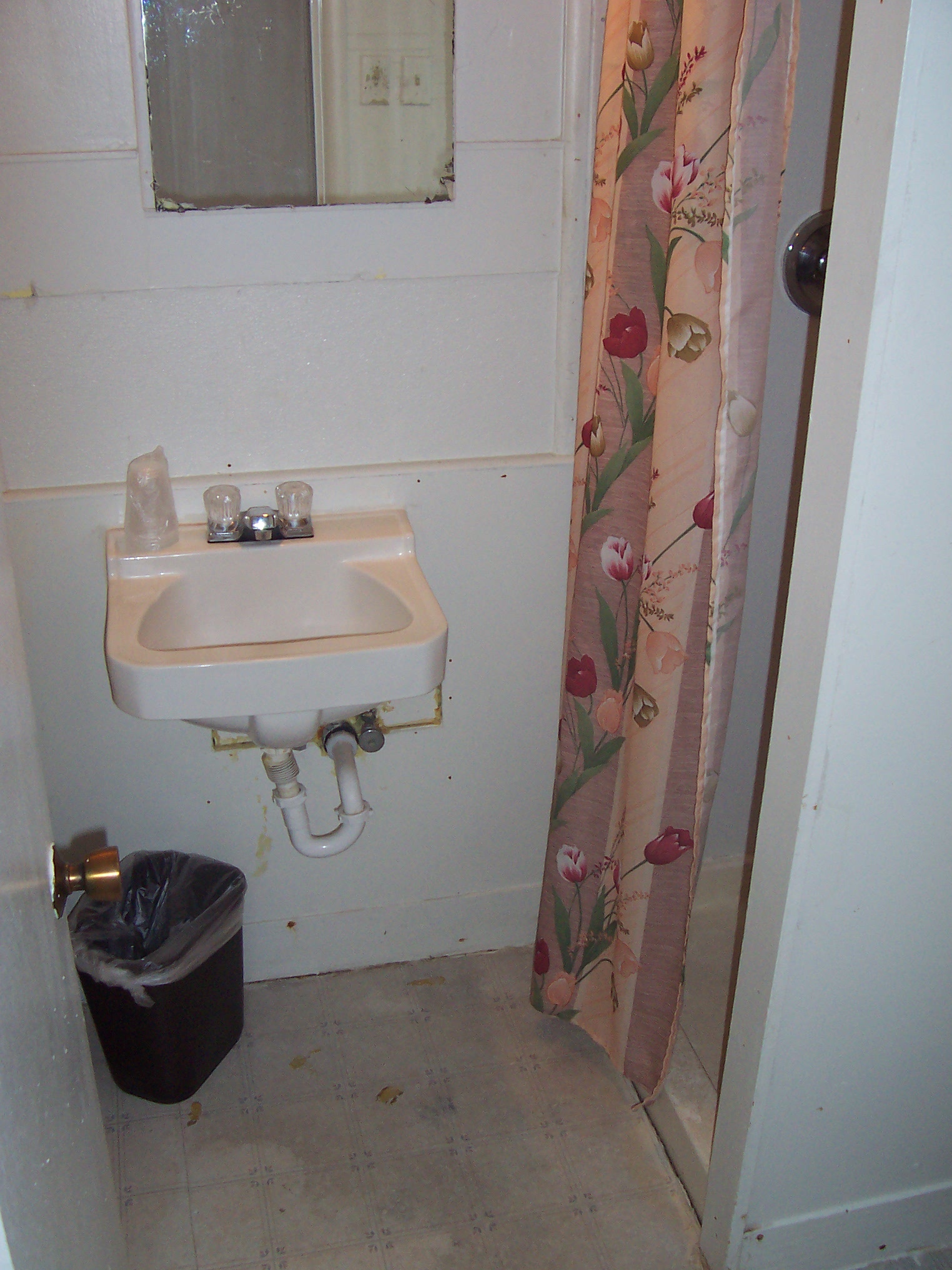
is the dingiest bathroom we’ve had the whole trip. But my low-quality camera pictures just don’t do it justice.
Next, we’ll be venturing into the rain forest outside Forks. Watching for vampires, of course.
